Laatste 6 dagenScroll naar links voor de laatste 6 dagenNu
Next 4 days weather summary:
Zware regen (totaal 36.0mm), zwaarst tijdens zaterdagmiddag. Warm (max 28°C op vrijdagmiddag, min 14°C op zaterdagavond). Wind zal licht zijn over het algemeen.
Dagen 5-7 St Johann-Alpendorf Weerssamenvatting
Matige regen (totaal 16.0mm), zwaarst op maandagavond. Warm (max 26°C op maandagmiddag, min 16°C op dinsdagavond). Wind zal licht zijn over het algemeen.
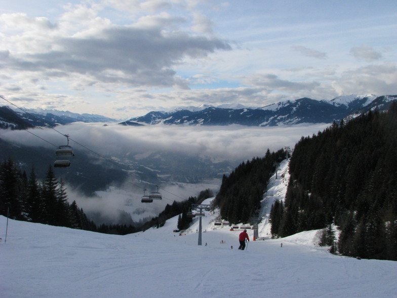
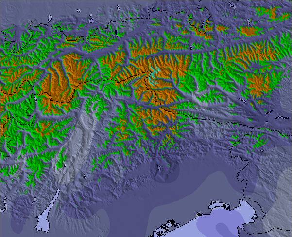
De bovenstaande tabel toont de weersverwachting voor St Johann-Alpendorf op een specifieke hoogte van 1342 m. Onze uiterst precieze weermodellen berekenen sneeuwverwachtingen voor de top, midden en dalstations van St Johann-Alpendorf. Voor weersverwachtingen op andere hoogtes, gebruik de tabbladen boven de tabel. Voor meer weer overzicht, zie de weerkaart van Austria.
Klik hier voor meer informatie over sneeuwhoogten en hoe we onze temperaturen berekenen.
Recensies van bezoekers van St Johann-Alpendorf
Algemeen 4.4 Gebaseerd op 10 Stem(men) en 17 beoordelingen
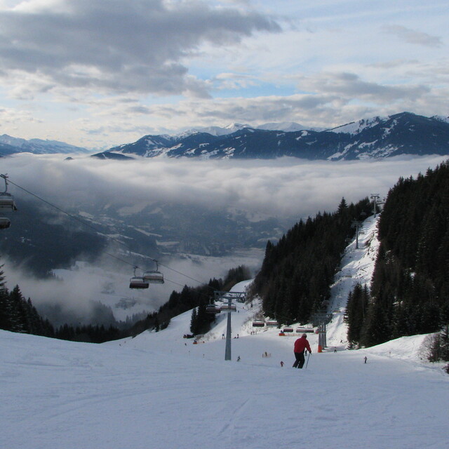
Here now at the peak week of the season. According to #WePowder, 5 million people headed to the Alps this week as the UK/Dutch and German half-term weeks created a perfect storm. Yes, it is crowded; avoid the bottom lifts between 08.45 and 09.45 and take a picnic as the restaurants are chaos, But the snow is the best in years; we've had two full on powder days and may even squeeze another in before the week is over. It is true that 80% of people go to 20% of the resorts, so we had a day in Grossarl (uncrowded) a day in Schladming (big enough to take the numbers) and will ski Hochkonig on "changeover" day, so it is possible to get some great runs in despite the crowds.
I can't comment on hotels but our 8 bed apartment in the Steakhouse Rauchkuchen at €750 per week is a bloody good deal. We're only 4 so plenty of room and usable kitchen.
Love Ski Amade and the Austrian Apres so much that we're buying in Flachau.
Off ski touring next week so may post an update.
Algemeen: 4.4 Gebaseerd op 10 Stem(men) en 17 beoordelingen
Sneeuwzekerheid
4.3
Piste Vercheidenheid
4.7
Off-Piste
3.1
Landschap
4.7
Na het Skiën
4.0
Simon van United Kingdom schrijft:
Here now at the peak week of the season. According to #WePowder, 5 million people headed to the Alps this week as the UK/Dutch and German half-term weeks created a perfect storm. Yes, it is crowded; avoid the bottom lifts between 08.45 and 09.45 and take a picnic as the restaurants are chaos, But the snow is the best in years; we've had two full on powder days and may even squeeze another in before the week is over. It is true that 80% of people go to 20% of the resorts, so we had a day in Grossarl (uncrowded) a day in Schladming (big enough to take the numbers) and will ski Hochkonig on "changeover" day, so it is possible to get some great runs in despite the crowds.
I can't comment on hotels but our 8 bed apartment in the Steakhouse Rauchkuchen at €750 per week is a bloody good deal. We're only 4 so plenty of room and usable kitchen.
Love Ski Amade and the Austrian Apres so much that we're buying in Flachau.
Off ski touring next week so may post an update.
Gratis Snow-Forecast.com weer-widget voor op je website
De skiweer-widget voor St Johann-Alpendorf is beschikbaar om gratis op te nemen op externe websites. De widget levert een dagelijkse samenvatting van onze sneeuwverwachtingen voor St Johann-Alpendorf en de huidige weersomstandigheden daar. Ga naar de configuratiepagina en volg de drie eenvoudige stappen om de aangepaste html-code te kopiëren en in uw site te plakken. U kunt de hoogte van de sneeuwvoorspelling kiezen (top, midden van de berg of dalstation) en metrische of imperiale eenheden voor de sneeuwverwachting, aangepast op uw eigen website…. Klik hier om de code te krijgen.


 Nearest