Laatste 6 dagenScroll naar links voor de laatste 6 dagenNu
Next 4 days weather summary:
Zware regen (totaal 42.0mm), zwaarst tijdens vrijdagavond. Warm (max 23°C op donderdagmiddag, min 13°C op vrijdagavond). Wind zal licht zijn over het algemeen.
Zware regen (totaal 31.0mm), zwaarst tijdens zondagmiddag. Zeer milde (max 18°C op maandagmiddag, min 9°C op zondagavond). Wind zal licht zijn over het algemeen.
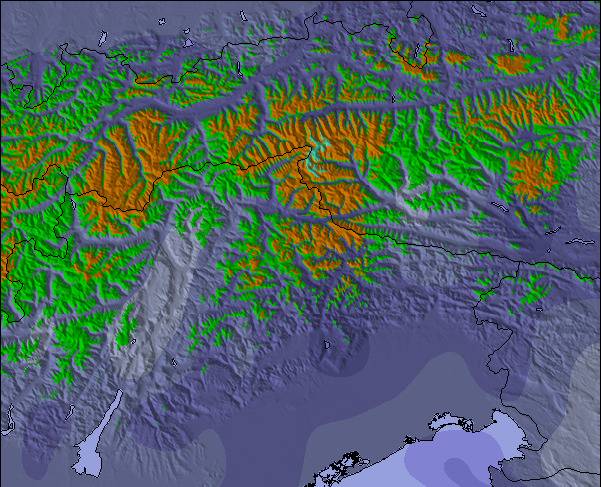
De bovenstaande tabel toont de weersverwachting voor Seefeld-Reith/Gschwandtkopf op een specifieke hoogte van 1500 m. Onze uiterst precieze weermodellen berekenen sneeuwverwachtingen voor de top, midden en dalstations van Seefeld-Reith/Gschwandtkopf. Voor weersverwachtingen op andere hoogtes, gebruik de tabbladen boven de tabel. Voor meer weer overzicht, zie de weerkaart van Austria.
Klik hier voor meer informatie over sneeuwhoogten en hoe we onze temperaturen berekenen.
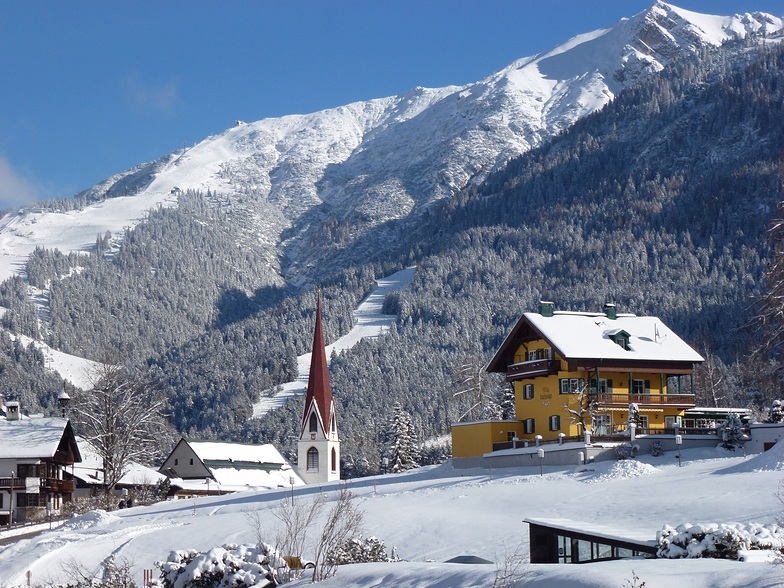
Skigebied wordt ook geschreven als Seefeld-Reith-Gschwandtkopf.
Recensies van bezoekers van Seefeld-Reith/Gschwandtkopf
Algemeen 3.9 Gebaseerd op 12 Stem(men) en 1 beoordeling
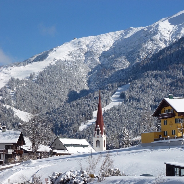
On the face of it Seefeld's second mountain has little to attract the diehard skier, but that would be to do the area a serious injustice!
With a vertical of only 300m this puts the Geschwandtkopf on a par and scale with say Glenshee, but beyond that all the comparables end. Why? Because all the runs are north facing so are snow sure through the season, the pistes are all deserted, so very little if any ice and the mountain has two FIS rated race pistes which many national teams train and race on.
Overall, the skiing is best suited to intermediates and beginners but advanced skiers will have a good day here too.
Add to all of this the subline views of the Inn Valley and Seefeld plateau, the high quality and very reasonably priced Sportalm at the bottom, which is perfect for celebrity spotting (we saw Claudia Schiffer there one Sunday!) and the fact that Seefeld is one of the best all-round winter sports resort in the Alps and you have the perfect ingredients for a very enjoyable day or two as an alternative Seefeld's other ski area the Rosshutte.
Recommended in small doses as part of a weeks stay in beautiful Seefeld.
Recensies van bezoekers van Seefeld-Reith/Gschwandtkopf
Algemeen: 3.9 Gebaseerd op 12 Stem(men) en 1 beoordeling
Sneeuwzekerheid
4.0
Piste Vercheidenheid
2.3
Off-Piste
2.5
Landschap
4.0
Na het Skiën
3.3
Tirolerhund van United Kingdom schrijft:
On the face of it Seefeld's second mountain has little to attract the diehard skier, but that would be to do the area a serious injustice!
With a vertical of only 300m this puts the Geschwandtkopf on a par and scale with say Glenshee, but beyond that all the comparables end. Why? Because all the runs are north facing so are snow sure through the season, the pistes are all deserted, so very little if any ice and the mountain has two FIS rated race pistes which many national teams train and race on.
Overall, the skiing is best suited to intermediates and beginners but advanced skiers will have a good day here too.
Add to all of this the subline views of the Inn Valley and Seefeld plateau, the high quality and very reasonably priced Sportalm at the bottom, which is perfect for celebrity spotting (we saw Claudia Schiffer there one Sunday!) and the fact that Seefeld is one of the best all-round winter sports resort in the Alps and you have the perfect ingredients for a very enjoyable day or two as an alternative Seefeld's other ski area the Rosshutte.
Recommended in small doses as part of a weeks stay in beautiful Seefeld.
Gratis Snow-Forecast.com weer-widget voor op je website
De skiweer-widget voor Seefeld-Reith/Gschwandtkopf is beschikbaar om gratis op te nemen op externe websites. De widget levert een dagelijkse samenvatting van onze sneeuwverwachtingen voor Seefeld-Reith/Gschwandtkopf en de huidige weersomstandigheden daar. Ga naar de configuratiepagina en volg de drie eenvoudige stappen om de aangepaste html-code te kopiëren en in uw site te plakken. U kunt de hoogte van de sneeuwvoorspelling kiezen (top, midden van de berg of dalstation) en metrische of imperiale eenheden voor de sneeuwverwachting, aangepast op uw eigen website…. Klik hier om de code te krijgen.


 Nearest