

America’s Next Indoor Snow Centre Takes Shape
Construction of a new indoor snow centre for skiers, boarders and tubers appears to be making good progress at Heritage Farm in Wayne County, West Virginia.

Next 3 days weather summary:Matige regen (totaal 11.0mm), zwaarst op dinsdagochtend. Milde temperaturen (max 8°C op woensdagmiddag, min 3°C op dinsdagavond). Wind zal licht zijn over het algemeen. | Dagen 4-6 Lech WeerssamenvattingZware regen (totaal 22.0mm), zwaarst tijdens zondagmiddag. Zeer milde (max 13°C op zaterdagmiddag, min 4°C op zondagavond). Wind zal licht zijn over het algemeen. | |||||||||||||||||
dinsdag 21 | woensdag 22 | donderdag 23 | vrijdag 24 | zaterdag 25 | zondag 26 | |||||||||||||
AM | PM | nacht | AM | PM | nacht | AM | PM | nacht | AM | PM | nacht | AM | PM | nacht | AM | PM | nacht | |
kans onweer | regenbuien | regenbuien | helder | helder | licht bewolkt | regenbuien | regenbuien | regenbuien | helder | helder | licht bewolkt | helder | licht bewolkt | regenbuien | regenbuien | lichte regen | gem. regen | |
km/h | ||||||||||||||||||
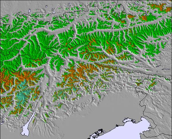
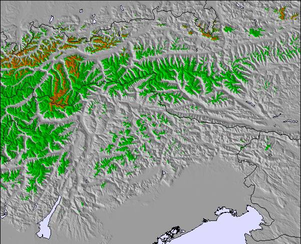
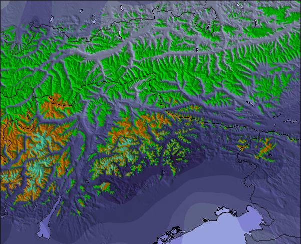
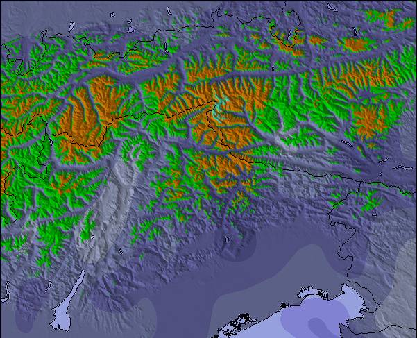
Sneeuw kaart |  |  |  |  |  |  | ||||||||||||
— | — | — | — | — | — | — | — | — | — | — | — | — | — | — | — | — | — | |
mm | 2 | 2 | 3 | — | — | — | 1 | 2 | 1 | — | — | — | — | — | 6 | 3 | 5 | 8 |
max °C | 6 | 6 | 4 | 6 | 8 | 7 | 5 | 5 | 5 | 8 | 9 | 9 | 11 | 13 | 10 | 8 | 7 | 5 |
min °C | 6 | 6 | 3 | 4 | 7 | 4 | 3 | 5 | 3 | 5 | 9 | 8 | 9 | 12 | 7 | 7 | 6 | 4 |
chill °C | 3 | 4 | 1 | 2 | 6 | 0 | -1 | 2 | 0 | 3 | 9 | 6 | 7 | 11 | 6 | 5 | 3 | 0 |
Vocht. % | 77 | 71 | 78 | 33 | 47 | 76 | 73 | 73 | 64 | 21 | 41 | 41 | 40 | 57 | 85 | 77 | 95 | 98 |
Vriespunt Niveau m | 3350 | 3100 | 2850 | 3300 | 3400 | 3100 | 3050 | 3050 | 2950 | 3650 | 3750 | 3900 | 3900 | 4000 | 3650 | 3500 | 3350 | 3150 |
5:43 | — | — | 5:45 | — | — | 5:46 | — | — | 5:47 | — | — | 5:48 | — | — | 5:50 | — | — | |
— | — | 9:06 | — | — | 9:05 | — | — | 9:04 | — | — | 9:02 | — | — | 9:01 | — | — | 9:00 | |
Word pro en carve uit:
Lawine-informatie: European Avalanche Warning Services (EAWS)
Laatste sneeuwrapporten in de buurt van Lech:
| Sneeuwdiepte op de top: | 0 cm |
|---|---|
| Sneeuwdiepte beneden: | 0 cm |
| Diepte verse sneeuw: | — |
| Laatste sneeuwval: | 10 Jun 2026 |
0.0 | Bluebird-poederdagen Verse sneeuw, meestal zonnig, lichte wind. |
|---|---|
0.1 | Poederdagen Verse sneeuw, vrij zonnig, wat wind. |
0.0 | Bluebird-dagen Gemiddelde sneeuw, meestal zonnig, lichte wind. |
De bovenstaande tabel toont de weersverwachting voor Lech op een specifieke hoogte van 2450 m. Onze uiterst precieze weermodellen berekenen sneeuwverwachtingen voor de top, midden en dalstations van Lech. Voor weersverwachtingen op andere hoogtes, gebruik de tabbladen boven de tabel. Voor meer weer overzicht, zie de weerkaart van Austria.
Klik hier voor meer informatie over sneeuwhoogten en hoe we onze temperaturen berekenen.
Algemeen 4.1 Gebaseerd op 25 Stem(men) en 20 beoordelingen
Good slopes. However, the overall attitude and unfriendliness is to the point of being disgusting. On a day to day basis I faced unfriendly waiters and personnel. Only for the rich who like an unfriendly attitude. The village of Lech is a representation of everything that went wrong with the ski-sport.
Pieter van Belgium schrijft:
Good slopes. However, the overall attitude and unfriendliness is to the point of being disgusting. On a day to day basis I faced unfriendly waiters and personnel. Only for the rich who like an unfriendly attitude. The village of Lech is a representation of everything that went wrong with the ski-sport.

 Nearest