

Portillo Re-Opens To Guests Arriving By Helicopter
Chile’s famous Portillo ski resort is reported to have re-opened to guests arriving by helicopter after being cut off by road for more than two weeks by over 6m/20 feet of snowfall.

Next 3 days weather summary:Zware regen (totaal 29.0mm), zwaarst tijdens dinsdagavond. Warm (max 30°C op maandagmiddag, min 16°C op maandagavond). Wind zal licht zijn over het algemeen. | Dagen 4-6 La Clusaz WeerssamenvattingLichte regen (totaal 9.0mm), vallende meestal op donderdagmiddag. Warm (max 25°C op zaterdagmiddag, min 14°C op donderdagavond). Wind zal licht zijn over het algemeen. | |||||||||||||||||
maandag 3 | dinsdag 4 | woensdag 5 | donderdag 6 | vrijdag 7 | zaterdag 8 | |||||||||||||
AM | PM | nacht | AM | PM | nacht | AM | PM | nacht | AM | PM | nacht | AM | PM | nacht | AM | PM | nacht | |
licht bewolkt | kans onweer | regenbuien | helder | kans onweer | regenbuien | helder | licht bewolkt | helder | helder | gem. regen | regenbuien | licht bewolkt | licht bewolkt | helder | helder | helder | helder | |
km/h | ||||||||||||||||||
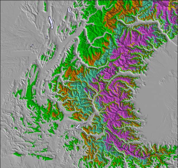
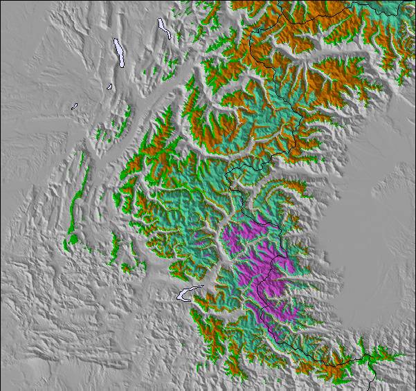
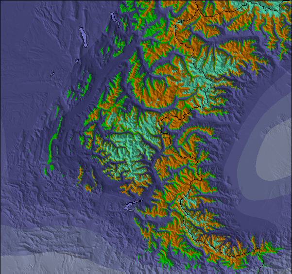
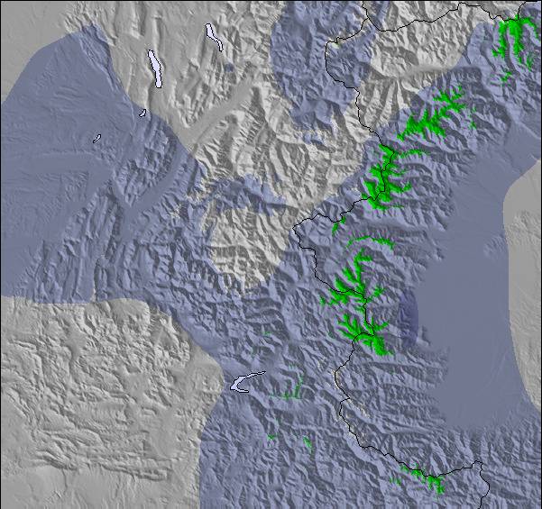
Sneeuw kaart |  |  |  |  |  |  | ||||||||||||
— | — | — | — | — | — | — | — | — | — | — | — | — | — | — | — | — | — | |
mm | — | 4 | 3 | — | 2 | 20 | — | — | — | — | 6 | 3 | — | — | — | — | — | — |
max °C | 28 | 30 | 21 | 24 | 27 | 18 | 24 | 27 | 23 | 24 | 20 | 18 | 18 | 22 | 20 | 21 | 25 | 21 |
min °C | 21 | 21 | 16 | 19 | 24 | 16 | 18 | 27 | 17 | 19 | 19 | 14 | 15 | 21 | 14 | 17 | 24 | 16 |
chill °C | 21 | 21 | 16 | 19 | 24 | 16 | 18 | 27 | 17 | 19 | 19 | 14 | 15 | 21 | 14 | 17 | 24 | 16 |
Vocht. % | 40 | 65 | 70 | 61 | 58 | 68 | 52 | 42 | 58 | 60 | 89 | 92 | 86 | 59 | 69 | 57 | 35 | 46 |
Vriespunt Niveau m | 4550 | 4500 | 4500 | 4450 | 4400 | 4400 | 4300 | 4350 | 4400 | 4300 | 4300 | 4200 | 4200 | 4300 | 4400 | 4350 | 4350 | 4250 |
6:18 | — | — | 6:18 | — | — | 6:20 | — | — | 6:22 | — | — | 6:22 | — | — | 6:24 | — | — | |
— | — | 9:00 | — | — | 9:00 | — | — | 8:58 | — | — | 8:57 | — | — | 8:55 | — | — | 8:53 | |
Word pro en carve uit:
Lawine-informatie: European Avalanche Warning Services (EAWS)
Laatste sneeuwrapporten in de buurt van La Clusaz:
| Sneeuwdiepte op de top: | 0 cm |
|---|---|
| Sneeuwdiepte beneden: | 0 cm |
| Diepte verse sneeuw: | — |
| Laatste sneeuwval: | 16 May 2026 |
0.0 | Bluebird-poederdagen Verse sneeuw, meestal zonnig, lichte wind. |
|---|---|
0.0 | Poederdagen Verse sneeuw, vrij zonnig, wat wind. |
0.0 | Bluebird-dagen Gemiddelde sneeuw, meestal zonnig, lichte wind. |

De bovenstaande tabel toont de weersverwachting voor La Clusaz op een specifieke hoogte van 984 m. Onze uiterst precieze weermodellen berekenen sneeuwverwachtingen voor de top, midden en dalstations van La Clusaz. Voor weersverwachtingen op andere hoogtes, gebruik de tabbladen boven de tabel. Voor meer weer overzicht, zie de weerkaart van France.
Klik hier voor meer informatie over sneeuwhoogten en hoe we onze temperaturen berekenen.
Algemeen 4.1 Gebaseerd op 41 Stem(men) en 24 beoordelingen
Actually under the name "La Clusaz" there are five interconnected ski centers with the same ticket: Balme, Aiguille, Etale, Beauregard and Manigod. Last year I visited Beauregard and Manigod. This year I skied Aiguille and Balme. So I am still missing Etale. I stayed in Annecy. It is about 30km far away from La Clusaz and an hour bus drive. I took the offer from Annecy bus station. At 40€ per person a lift ticket and bus transfer are included. Really good price! The bus leaves from Annecy at 09:30 and returns at 17:00. I skied on Friday, 16th February 2018. What a fantastic ski day. I was really worried about rain that had fallen the last day. However, the rain caused no problem. Temperature was at about 6C in the base and around freezing level at the top of the mountains (approximately 2.500m). I rented good ski equipment at 27€/day. I started skiing in Auguille. The only piste in not so good condition was Merle, because there were too many people skiing on it. However, and despite the fact it was French winter school holidays and the ski center was really busy, there were almost no queues at the lifts. Snow coverage was really good: 40 cm at the base and more than 3 meters on the top. Not a single stone in the whole ski center. The weather was very changeable. In the lower slopes, there was little rain. In some slopes there was sun. On the top of the mountains (Aiguille and Balme as well) there was dense fog. On the top of Balme (piste Blanchot) it was snowing heavily. What a weather mixture in one single day and a single ski center! In my opinion, the best mountain is Balme. You do not need to take the gondola from Aiguille. I skied down the red piste La Fernuy. It was written that the piste was not prepared and the snow was heavy. Well, this was not true. Fernuy was pretty nice and the view from there was fantastic. Furthermore, Balme was much quiter than Aiguille and a lot more enjoyable, as the mountain was virtually empty from skiers. The red Blanchot, Torchere and Lachat were really good. Up on the top, in the beginning and the middle of Blanchot, it was snowing heavily. Down further, the weather cleared. I skied the red Lachat, which is a big red piste, totally alone! La Clusaz consists mostly of blue and red pistes. It is the paradise of the interemediate skier. You need at least three full days to visit all the five interconnected ski centers. Overall, it was one the best skiing experiences ever from all the aspects. La Clusaz is totally recommended!
Derion van Greece schrijft:
Actually under the name "La Clusaz" there are five interconnected ski centers with the same ticket: Balme, Aiguille, Etale, Beauregard and Manigod. Last year I visited Beauregard and Manigod. This year I skied Aiguille and Balme. So I am still missing Etale. I stayed in Annecy. It is about 30km far away from La Clusaz and an hour bus drive. I took the offer from Annecy bus station. At 40€ per person a lift ticket and bus transfer are included. Really good price! The bus leaves from Annecy at 09:30 and returns at 17:00. I skied on Friday, 16th February 2018. What a fantastic ski day. I was really worried about rain that had fallen the last day. However, the rain caused no problem. Temperature was at about 6C in the base and around freezing level at the top of the mountains (approximately 2.500m). I rented good ski equipment at 27€/day. I started skiing in Auguille. The only piste in not so good condition was Merle, because there were too many people skiing on it. However, and despite the fact it was French winter school holidays and the ski center was really busy, there were almost no queues at the lifts. Snow coverage was really good: 40 cm at the base and more than 3 meters on the top. Not a single stone in the whole ski center. The weather was very changeable. In the lower slopes, there was little rain. In some slopes there was sun. On the top of the mountains (Aiguille and Balme as well) there was dense fog. On the top of Balme (piste Blanchot) it was snowing heavily. What a weather mixture in one single day and a single ski center! In my opinion, the best mountain is Balme. You do not need to take the gondola from Aiguille. I skied down the red piste La Fernuy. It was written that the piste was not prepared and the snow was heavy. Well, this was not true. Fernuy was pretty nice and the view from there was fantastic. Furthermore, Balme was much quiter than Aiguille and a lot more enjoyable, as the mountain was virtually empty from skiers. The red Blanchot, Torchere and Lachat were really good. Up on the top, in the beginning and the middle of Blanchot, it was snowing heavily. Down further, the weather cleared. I skied the red Lachat, which is a big red piste, totally alone! La Clusaz consists mostly of blue and red pistes. It is the paradise of the interemediate skier. You need at least three full days to visit all the five interconnected ski centers. Overall, it was one the best skiing experiences ever from all the aspects. La Clusaz is totally recommended!

 Nearest