Laatste 6 dagenScroll naar links voor de laatste 6 dagenNu
Next 4 days weather summary:
Zware regen (totaal 33.0mm), zwaarst tijdens zaterdagavond. Zeer milde (max 17°C op vrijdagmiddag, min 9°C op zaterdagavond). Wind zal licht zijn over het algemeen.
Dagen 5-7 Kühtai Weerssamenvatting
Zware regen (totaal 23.0mm), zwaarst tijdens dinsdagmiddag. Zeer milde (max 15°C op maandagmiddag, min 10°C op dinsdagavond). Wind zal licht zijn over het algemeen.
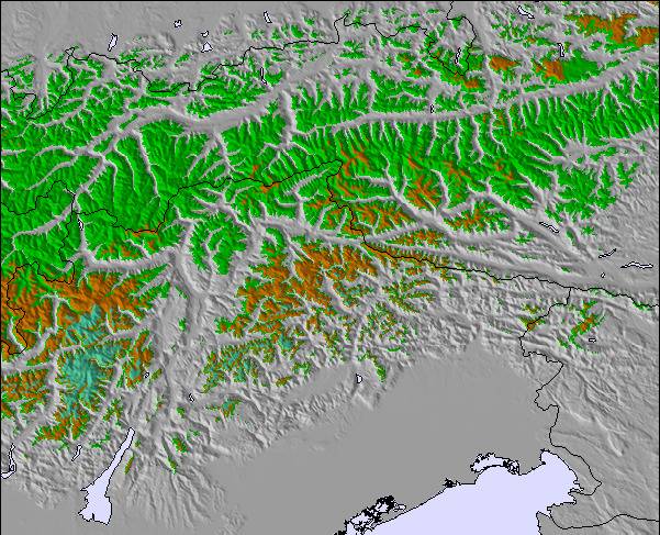
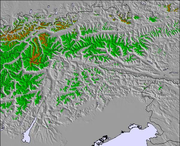
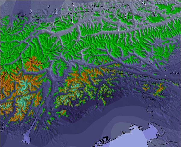
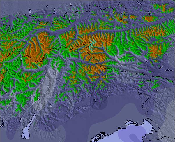
De bovenstaande tabel toont de weersverwachting voor Kühtai op een specifieke hoogte van 2520 m. Onze uiterst precieze weermodellen berekenen sneeuwverwachtingen voor de top, midden en dalstations van Kühtai. Voor weersverwachtingen op andere hoogtes, gebruik de tabbladen boven de tabel. Voor meer weer overzicht, zie de weerkaart van Austria.
Klik hier voor meer informatie over sneeuwhoogten en hoe we onze temperaturen berekenen.
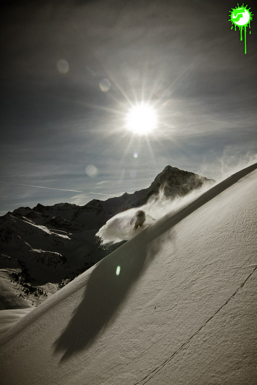
Skigebied wordt ook geschreven als Kuehtai.
Recensies van bezoekers van Kühtai
Algemeen 4.1 Gebaseerd op 23 Stem(men) en 7 beoordelingen
Kuhtai is a small steep resort with limited blue run skiing. There are a couple of blues higher up the mountain but you have to ski down quite a steep red run to get back to base. There is no lift back option unless you're prepared to walk back up the slope to the gondola. Of course this is no problem for most skiers but learners and people lacking in confidence beware. I, on the other hand, am an experienced skier with a 6 year old lad that happens to be fearless so it's great. Hotel Elisabeth is great, on the slope, next to the lift. Kuhtai also has night skiing which is a great experience. It's only 40 mins from Innsbruck Airport, much cheaper than other resorts for ski pass, accommodation etc and is big enough for a small family and the less experienced. If you wish to venture further then you can catch a free bus to a resort down the road. The lift pass covers both resorts. The snow conditions are always good due to it being the highest resort in Austria and the slopes are always well groomed and quite. If you like off-piste then there's a great damm wall you can ski down plus other bits and pieces. There's also a fantastic toboggan run that's about 2 miles long where you can hire a sledge and get a lift. If you want value and quality but can live with a small resort and can ski then it's great. Let's face it, if you find a nice ski run in a large resort then sometimes it's better to ski the one you like rather than traipse from resort to resort and plan to get back on time or you can find yourself stuck in another valley facing a very expensive taxi back. All the ski runs are good and lead back to the main village. Throw the lift pass away and enjoy the slopes!
Algemeen: 4.1 Gebaseerd op 23 Stem(men) en 7 beoordelingen
Sneeuwzekerheid
4.9
Piste Vercheidenheid
3.9
Off-Piste
3.7
Landschap
4.0
Na het Skiën
3.3
Jonathan Brook van United Kingdom schrijft:
Kuhtai is a small steep resort with limited blue run skiing. There are a couple of blues higher up the mountain but you have to ski down quite a steep red run to get back to base. There is no lift back option unless you're prepared to walk back up the slope to the gondola. Of course this is no problem for most skiers but learners and people lacking in confidence beware. I, on the other hand, am an experienced skier with a 6 year old lad that happens to be fearless so it's great. Hotel Elisabeth is great, on the slope, next to the lift. Kuhtai also has night skiing which is a great experience. It's only 40 mins from Innsbruck Airport, much cheaper than other resorts for ski pass, accommodation etc and is big enough for a small family and the less experienced. If you wish to venture further then you can catch a free bus to a resort down the road. The lift pass covers both resorts. The snow conditions are always good due to it being the highest resort in Austria and the slopes are always well groomed and quite. If you like off-piste then there's a great damm wall you can ski down plus other bits and pieces. There's also a fantastic toboggan run that's about 2 miles long where you can hire a sledge and get a lift. If you want value and quality but can live with a small resort and can ski then it's great. Let's face it, if you find a nice ski run in a large resort then sometimes it's better to ski the one you like rather than traipse from resort to resort and plan to get back on time or you can find yourself stuck in another valley facing a very expensive taxi back. All the ski runs are good and lead back to the main village. Throw the lift pass away and enjoy the slopes!
Gratis Snow-Forecast.com weer-widget voor op je website
De skiweer-widget voor Kühtai is beschikbaar om gratis op te nemen op externe websites. De widget levert een dagelijkse samenvatting van onze sneeuwverwachtingen voor Kühtai en de huidige weersomstandigheden daar. Ga naar de configuratiepagina en volg de drie eenvoudige stappen om de aangepaste html-code te kopiëren en in uw site te plakken. U kunt de hoogte van de sneeuwvoorspelling kiezen (top, midden van de berg of dalstation) en metrische of imperiale eenheden voor de sneeuwverwachting, aangepast op uw eigen website…. Klik hier om de code te krijgen.


 Nearest