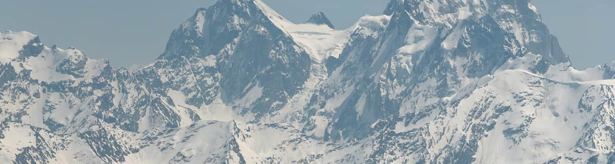


Portillo Storm Snowfall Total Passes 5m / 17 Feet
A snow storm that has now continued for nine days has taken Chilean ski resort Portillo to a snowfall total of 5.2 metres (17 feet) so far, with more snow forecast.

Next 3 days weather summary:Lichte regen (totaal 9.0mm), vallende meestal op zondagmiddag. Zeer milde (max 14°C op dinsdagmiddag, min 5°C op zondagmiddag). Wind zal licht zijn over het algemeen. | Dagen 4-6 Kappl WeerssamenvattingLichte regen (totaal 9.0mm), vallende meestal op woensdagmiddag. Zeer milde (max 18°C op vrijdagmiddag, min 11°C op woensdagavond). Wind zal licht zijn over het algemeen. | ||||||||||||||||
zon 26 | maandag 27 | dinsdag 28 | woensdag 29 | donderdag 30 | vrijdag 31 | ||||||||||||
PM | nacht | AM | PM | nacht | AM | PM | nacht | AM | PM | nacht | AM | PM | nacht | AM | PM | nacht | |
lichte regen | regenbuien | helder | helder | helder | helder | helder | helder | kans onweer | kans onweer | regenbuien | helder | helder | helder | helder | helder | kans onweer | |
km/h | |||||||||||||||||
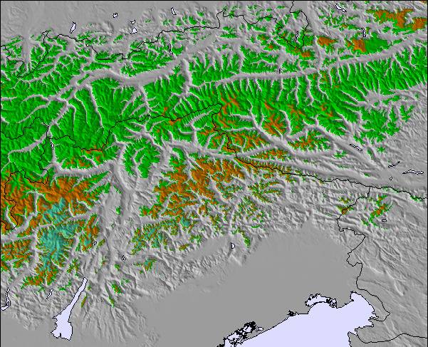
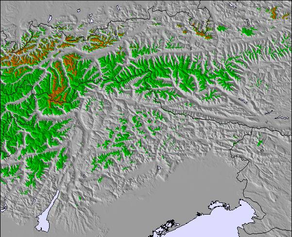
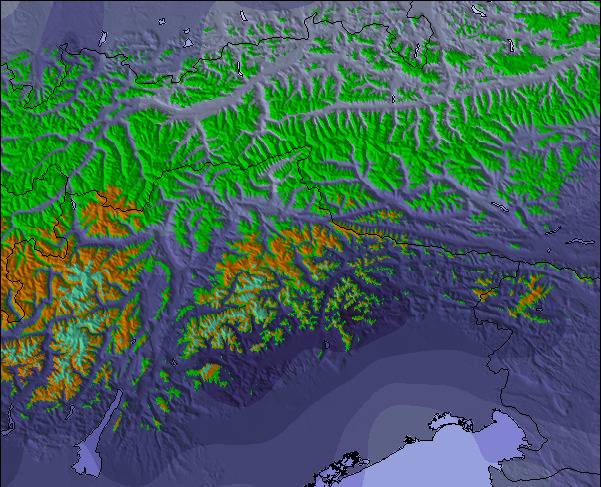
Sneeuw kaart |  |  |  |  |  |  | |||||||||||
— | — | — | — | — | — | — | — | — | — | — | — | — | — | — | — | — | |
mm | 5 | 2 | — | — | — | — | — | — | 2 | 3 | 2 | — | — | — | — | — | 3 |
max °C | 6 | 6 | 6 | 9 | 9 | 12 | 14 | 13 | 12 | 13 | 13 | 13 | 16 | 16 | 16 | 18 | 18 |
min °C | 5 | 5 | 5 | 8 | 8 | 10 | 13 | 11 | 11 | 13 | 11 | 12 | 15 | 14 | 14 | 17 | 13 |
chill °C | 3 | 3 | 3 | 7 | 7 | 10 | 13 | 11 | 11 | 13 | 10 | 12 | 15 | 14 | 14 | 17 | 12 |
Vocht. % | 89 | 80 | 80 | 68 | 42 | 32 | 53 | 74 | 73 | 71 | 60 | 41 | 38 | 41 | 36 | 31 | 53 |
Vriespunt Niveau m | 3550 | 3500 | 3600 | 4100 | 4400 | 4550 | 4650 | 4500 | 4300 | 4500 | 4450 | 4450 | 4750 | 4750 | 4700 | 4900 | 4750 |
— | — | 5:50 | — | — | 5:52 | — | — | 5:52 | — | — | 5:54 | — | — | 5:54 | — | — | |
— | 8:59 | — | — | 8:58 | — | — | 8:57 | — | — | 8:55 | — | — | 8:53 | — | — | 8:52 | |
Word pro en carve uit:
Lawine-informatie: European Avalanche Warning Services (EAWS)
Laatste sneeuwrapporten in de buurt van Kappl:
| Sneeuwdiepte op de top: | 0 cm |
|---|---|
| Sneeuwdiepte beneden: | 0 cm |
| Diepte verse sneeuw: | — |
| Laatste sneeuwval: | 10 Jun 2026 |
0.1 | Bluebird-poederdagen Verse sneeuw, meestal zonnig, lichte wind. |
|---|---|
0.4 | Poederdagen Verse sneeuw, vrij zonnig, wat wind. |
0.0 | Bluebird-dagen Gemiddelde sneeuw, meestal zonnig, lichte wind. |
De bovenstaande tabel toont de weersverwachting voor Kappl op een specifieke hoogte van 2690 m. Onze uiterst precieze weermodellen berekenen sneeuwverwachtingen voor de top, midden en dalstations van Kappl. Voor weersverwachtingen op andere hoogtes, gebruik de tabbladen boven de tabel. Voor meer weer overzicht, zie de weerkaart van Austria.
Klik hier voor meer informatie over sneeuwhoogten en hoe we onze temperaturen berekenen.
Algemeen 3.4 Gebaseerd op 13 Stem(men) en 3 beoordelingen
We've had an extraordinary holiday in Kapple (Kappl); it really is a perfect resort for families and for kids. It is for skiing and for resting, not so many people, can watch the kids, not being afraid of too much speed. Many pistes at Kappl, enough action, enough space. A lot of beauty and a lot of nature. In my opinion this resort offers the possibility of feeling good by practicing ski and if you want more there are possibilities of skibuses. Go in the neighbourhood. Changing the resort for 1 or 2 days. The weather was also perfect at Kappl, even if in the village there is not a lot of sun, up in the mountains there was plenty of it. Good luck!
FLORIAN van Romania schrijft:
We've had an extraordinary holiday in Kapple (Kappl); it really is a perfect resort for families and for kids. It is for skiing and for resting, not so many people, can watch the kids, not being afraid of too much speed. Many pistes at Kappl, enough action, enough space. A lot of beauty and a lot of nature. In my opinion this resort offers the possibility of feeling good by practicing ski and if you want more there are possibilities of skibuses. Go in the neighbourhood. Changing the resort for 1 or 2 days. The weather was also perfect at Kappl, even if in the village there is not a lot of sun, up in the mountains there was plenty of it.
Good luck!

 Nearest