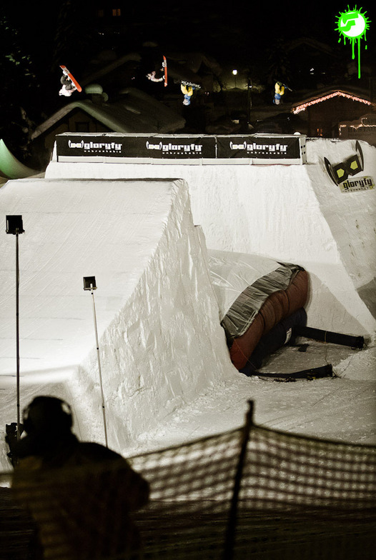


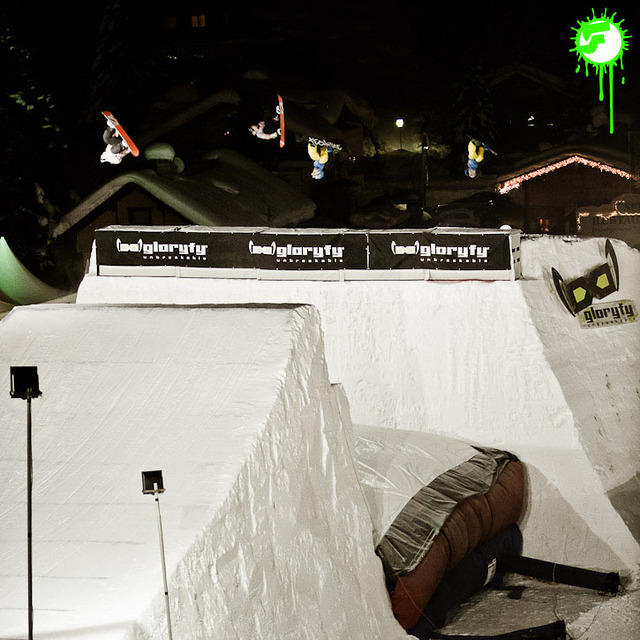
America’s Next Indoor Snow Centre Takes Shape
Construction of a new indoor snow centre for skiers, boarders and tubers appears to be making good progress at Heritage Farm in Wayne County, West Virginia.

Next 3 days weather summary:Matige regen (totaal 14.0mm), zwaarst op donderdagmiddag. Zeer milde (max 13°C op woensdagmiddag, min 4°C op donderdagavond). Wind zal licht zijn over het algemeen. | Dagen 4-6 Gerlos WeerssamenvattingZware regen (totaal 32.0mm), zwaarst tijdens zondagavond. Zeer milde (max 19°C op zaterdagmiddag, min 6°C op vrijdagochtend). Wind zal licht zijn over het algemeen. | |||||||||||||||||
dinsdag 21 | woensdag 22 | donderdag 23 | vrijdag 24 | zaterdag 25 | zondag 26 | |||||||||||||
AM | PM | nacht | AM | PM | nacht | AM | PM | nacht | AM | PM | nacht | AM | PM | nacht | AM | PM | nacht | |
kans onweer | lichte regen | regenbuien | helder | helder | licht bewolkt | regenbuien | regenbuien | regenbuien | helder | helder | licht bewolkt | helder | licht bewolkt | gem. regen | gem. regen | gem. regen | zware regen | |
km/h | ||||||||||||||||||
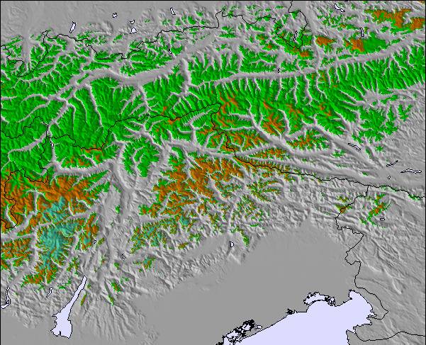
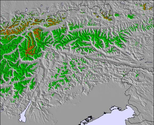
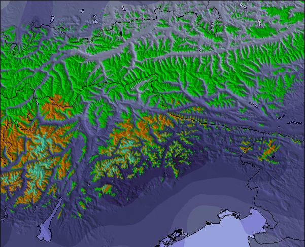
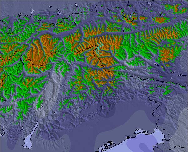
Sneeuw kaart |  |  |  |  |  |  | ||||||||||||
— | — | — | — | — | — | — | — | — | — | — | — | — | — | — | — | — | — | |
mm | 1 | 2 | 2 | — | — | — | 2 | 4 | 3 | — | — | — | — | — | 8 | 6 | 7 | 11 |
max °C | 11 | 11 | 7 | 9 | 13 | 10 | 9 | 9 | 7 | 10 | 13 | 12 | 15 | 19 | 14 | 12 | 12 | 9 |
min °C | 9 | 9 | 5 | 6 | 12 | 7 | 7 | 9 | 4 | 6 | 12 | 9 | 12 | 18 | 10 | 9 | 10 | 8 |
chill °C | 9 | 8 | 5 | 5 | 12 | 6 | 6 | 7 | 3 | 5 | 11 | 8 | 11 | 18 | 9 | 9 | 10 | 8 |
Vocht. % | 72 | 80 | 86 | 53 | 46 | 69 | 73 | 76 | 83 | 43 | 41 | 47 | 43 | 36 | 78 | 71 | 89 | 91 |
Vriespunt Niveau m | 3350 | 3100 | 2800 | 3100 | 3250 | 3100 | 2950 | 2950 | 2700 | 3200 | 3450 | 3850 | 3850 | 4150 | 3950 | 3550 | 3500 | 3200 |
5:35 | — | — | 5:37 | — | — | 5:37 | — | — | 5:39 | — | — | 5:41 | — | — | 5:41 | — | — | |
— | — | 8:59 | — | — | 8:58 | — | — | 8:57 | — | — | 8:54 | — | — | 8:53 | — | — | 8:52 | |
Word pro en carve uit:
Lawine-informatie: European Avalanche Warning Services (EAWS)
Laatste sneeuwrapporten in de buurt van Gerlos:
| Sneeuwdiepte op de top: | — |
|---|---|
| Sneeuwdiepte beneden: | — |
| Diepte verse sneeuw: | — |
| Laatste sneeuwval: | 10 Jun 2026 |
0.0 | Bluebird-poederdagen Verse sneeuw, meestal zonnig, lichte wind. |
|---|---|
0.0 | Poederdagen Verse sneeuw, vrij zonnig, wat wind. |
0.0 | Bluebird-dagen Gemiddelde sneeuw, meestal zonnig, lichte wind. |
De bovenstaande tabel toont de weersverwachting voor Gerlos op een specifieke hoogte van 1872 m. Onze uiterst precieze weermodellen berekenen sneeuwverwachtingen voor de top, midden en dalstations van Gerlos. Voor weersverwachtingen op andere hoogtes, gebruik de tabbladen boven de tabel. Voor meer weer overzicht, zie de weerkaart van Austria.
Klik hier voor meer informatie over sneeuwhoogten en hoe we onze temperaturen berekenen.
Algemeen 4.0 Gebaseerd op 1 Stem(men) en 4 beoordelingen
Small Austrian resort towns tick a lot of boxes for me, and when I came across this one online, I was surprised I hadn't heard of it, since it has great credentials. The reason is that it attracts lots of Dutch, but few Brits. This is fine by me! Mayrhofen, in the next valley, is party central for the English, but Gerlos has plenty of advantages. It's small and pretty, with lovely traditional chalet architecture. There is a good selection of bars and restaurants, and an abundance of 4* hotels. Best of all, the 2 lifts in the village are within a 5 minute walk of nearly all the accommodation, and you can ski right into the village centre as well. As for the skiing, well it is rather good, especially for covering the miles as intermediates. Gerlos is in the centre of the Zillertal ski area, and is fine. The Zell sector really stands out though, with an extensive, fairly high altitude section (2000-2500m ) and really lovely blues and reds through the trees lower down. Konigsleiten, at the other end of the system is also recommended. The setting of this purpose built little village, which seems to consist almost entirely of chalets, is lovely indeed. Situated at the top of a pass, this resort feels quite high and remote, and looks to be pretty much all ski in-ski out. Overall, there are very few black runs, and the one or two we did find we felt were little different from the reds, so it is not the place for expert thrill seekers. Having said that, the quantity of off-piste and its easy accessibility right by the side of the pistes, is a big plus. The mountain restaurants and very plentiful and very good. Other pluses: very short transfer (70 minutes from Innsbruck, we got a rare ski session on the first afternoon), significantly lower prices than France (30% less here for hotel, food, drink) and better mountain food. There is a better resort atmosphere as well, and it is good to feel like you are a person, not just a digit in a constantly churning mega ski factory. And the views are glorious in every direction.
Paul van United Kingdom schrijft:
Small Austrian resort towns tick a lot of boxes for me, and when I came across this one online, I was surprised I hadn't heard of it, since it has great credentials. The reason is that it attracts lots of Dutch, but few Brits. This is fine by me! Mayrhofen, in the next valley, is party central for the English, but Gerlos has plenty of advantages. It's small and pretty, with lovely traditional chalet architecture. There is a good selection of bars and restaurants, and an abundance of 4* hotels. Best of all, the 2 lifts in the village are within a 5 minute walk of nearly all the accommodation, and you can ski right into the village centre as well.
As for the skiing, well it is rather good, especially for covering the miles as intermediates. Gerlos is in the centre of the Zillertal ski area, and is fine. The Zell sector really stands out though, with an extensive, fairly high altitude section (2000-2500m ) and really lovely blues and reds through the trees lower down. Konigsleiten, at the other end of the system is also recommended. The setting of this purpose built little village, which seems to consist almost entirely of chalets, is lovely indeed. Situated at the top of a pass, this resort feels quite high and remote, and looks to be pretty much all ski in-ski out.
Overall, there are very few black runs, and the one or two we did find we felt were little different from the reds, so it is not the place for expert thrill seekers. Having said that, the quantity of off-piste and its easy accessibility right by the side of the pistes, is a big plus.
The mountain restaurants and very plentiful and very good.
Other pluses: very short transfer (70 minutes from Innsbruck, we got a rare ski session on the first afternoon), significantly lower prices than France (30% less here for hotel, food, drink) and better mountain food. There is a better resort atmosphere as well, and it is good to feel like you are a person, not just a digit in a constantly churning mega ski factory. And the views are glorious in every direction.

 Nearest