

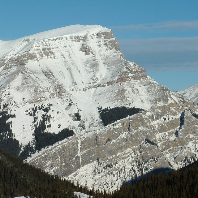
Portillo Re-Opens To Guests Arriving By Helicopter
Chile’s famous Portillo ski resort is reported to have re-opened to guests arriving by helicopter after being cut off by road for more than two weeks by over 6m/20 feet of snowfall.

Next 3 days weather summary:Meestal droog. Warm (max 21°C op woensdagmiddag, min 7°C op maandagochtend). Wind zal licht zijn over het algemeen. | Dagen 4-6 Banff Mt Norquay WeerssamenvattingMatige regen (totaal 18.0mm), zwaarst op zaterdagmiddag. Warm (max 22°C op donderdagmiddag, min 10°C op zaterdagavond). Wind zal licht zijn over het algemeen. | |||||||||||||||||
maandag 3 | dinsdag 4 | woensdag 5 | donderdag 6 | vrijdag 7 | zaterdag 8 | |||||||||||||
AM | PM | nacht | AM | PM | nacht | AM | PM | nacht | AM | PM | nacht | AM | PM | nacht | AM | PM | nacht | |
licht bewolkt | bewolkt | licht bewolkt | helder | licht bewolkt | bewolkt | licht bewolkt | helder | helder | helder | licht bewolkt | licht bewolkt | licht bewolkt | kans onweer | regenbuien | regenbuien | gem. regen | regenbuien | |
km/h | ||||||||||||||||||
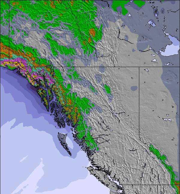
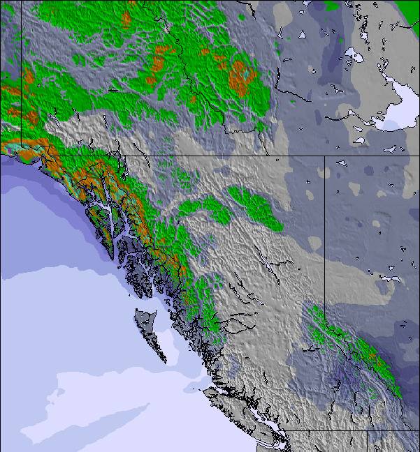
Sneeuw kaart | 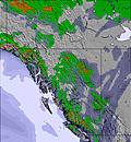 | 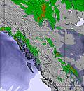 | 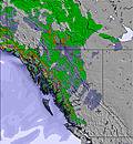 | 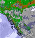 | 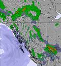 | 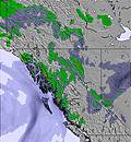 | ||||||||||||
— | — | — | — | — | — | — | — | — | — | — | — | — | — | — | — | — | — | |
mm | — | — | — | — | — | — | — | — | — | — | — | — | — | 2 | 2 | 2 | 8 | 4 |
max °C | 11 | 14 | 10 | 14 | 18 | 16 | 17 | 21 | 19 | 18 | 22 | 16 | 20 | 21 | 14 | 16 | 17 | 12 |
min °C | 7 | 14 | 7 | 10 | 17 | 11 | 13 | 20 | 12 | 14 | 22 | 12 | 14 | 17 | 11 | 13 | 13 | 10 |
chill °C | 6 | 14 | 7 | 10 | 17 | 11 | 13 | 20 | 12 | 14 | 22 | 12 | 14 | 17 | 11 | 13 | 13 | 10 |
Vocht. % | 62 | 28 | 61 | 51 | 26 | 46 | 47 | 26 | 58 | 62 | 26 | 83 | 66 | 34 | 88 | 77 | 55 | 90 |
Vriespunt Niveau m | 2700 | 3350 | 3300 | 3250 | 3850 | 3950 | 3800 | 4350 | 4300 | 4100 | 4450 | 4500 | 4350 | 4300 | 4050 | 3900 | 4050 | 3950 |
6:09 | — | — | 6:11 | — | — | 6:11 | — | — | 6:13 | — | — | 6:15 | — | — | 6:16 | — | — | |
— | — | 9:25 | — | — | 9:23 | — | — | 9:22 | — | — | 9:20 | — | — | 9:19 | — | — | 9:16 | |
Word pro en carve uit:
Lawine-informatie: Avalanche Canada
Laatste sneeuwrapporten in de buurt van Banff Mt Norquay:
| Sneeuwdiepte op de top: | 0 cm |
|---|---|
| Sneeuwdiepte beneden: | 0 cm |
| Diepte verse sneeuw: | — |
| Laatste sneeuwval: | 7 Jun 2026 |
0.0 | Bluebird-poederdagen Verse sneeuw, meestal zonnig, lichte wind. |
|---|---|
0.0 | Poederdagen Verse sneeuw, vrij zonnig, wat wind. |
0.0 | Bluebird-dagen Gemiddelde sneeuw, meestal zonnig, lichte wind. |
De bovenstaande tabel toont de weersverwachting voor Banff Mt Norquay op een specifieke hoogte van 1790 m. Onze uiterst precieze weermodellen berekenen sneeuwverwachtingen voor de top, midden en dalstations van Banff Mt Norquay. Voor weersverwachtingen op andere hoogtes, gebruik de tabbladen boven de tabel. Voor meer weer overzicht, zie de weerkaart van Canada.
Klik hier voor meer informatie over sneeuwhoogten en hoe we onze temperaturen berekenen.
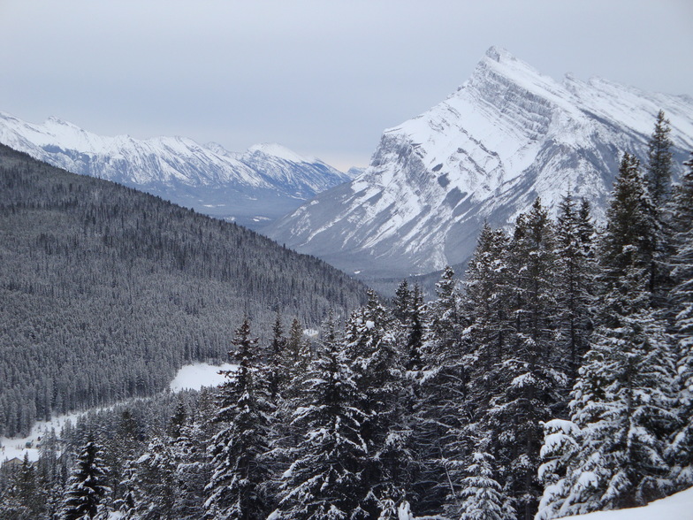
Skigebied wordt ook geschreven als Banff Mount Norquay.
Algemeen 3.4 Gebaseerd op 20 Stem(men) en 14 beoordelingen
I heard a lot about Norquay being smaller than Louise or Sunshine. It's true, but no line-ups (even at Xmas) and a crazy 'tubing' faster than anywhere I know! Super staff, super groomed slopes and still crazy chutes if you can walk 5 min. On north east storms this is the place to be! They receive tonnes of snow from the north east. The lines are steep and no flats like Sunshine... Only 5 min from Banff. You can just go there for 1 or 2 hours on lunch brake or for a bit of park practice. Don t miss it!
Steve van France schrijft:
I heard a lot about Norquay being smaller than Louise or Sunshine. It's true, but no line-ups (even at Xmas) and a crazy 'tubing' faster than anywhere I know!
Super staff, super groomed slopes and still crazy chutes if you can walk 5 min.
On north east storms this is the place to be! They receive tonnes of snow from the north east.
The lines are steep and no flats like Sunshine...
Only 5 min from Banff. You can just go there for 1 or 2 hours on lunch brake or for a bit of park practice.
Don t miss it!
Lees 13 meer recensies van Banff Mt Norquay of stuur je eigen in

 Nearest