Laatste 6 dagenScroll naar links voor de laatste 6 dagenNu
Next 4 days weather summary:
Zware regen (totaal 32.0mm), zwaarst tijdens zaterdagavond. Warm (max 27°C op vrijdagmiddag, min 17°C op zaterdagavond). Wind zal licht zijn over het algemeen.
Dagen 5-7 Lenggries Weerssamenvatting
Zware regen (totaal 26.0mm), zwaarst tijdens zondagavond. Warm (max 26°C op maandagmiddag, min 19°C op zondagavond). Wind zal licht zijn over het algemeen.
De bovenstaande tabel toont de weersverwachting voor Lenggries op een specifieke hoogte van 1200 m. Onze uiterst precieze weermodellen berekenen sneeuwverwachtingen voor de top, midden en dalstations van Lenggries. Voor weersverwachtingen op andere hoogtes, gebruik de tabbladen boven de tabel. Voor meer weer overzicht, zie de weerkaart van Germany.
Klik hier voor meer informatie over sneeuwhoogten en hoe we onze temperaturen berekenen.
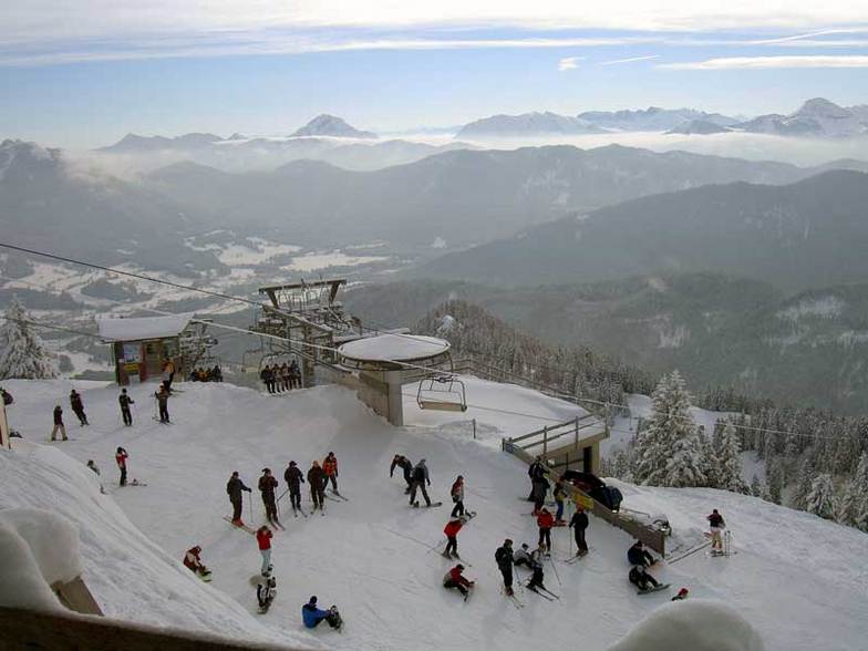
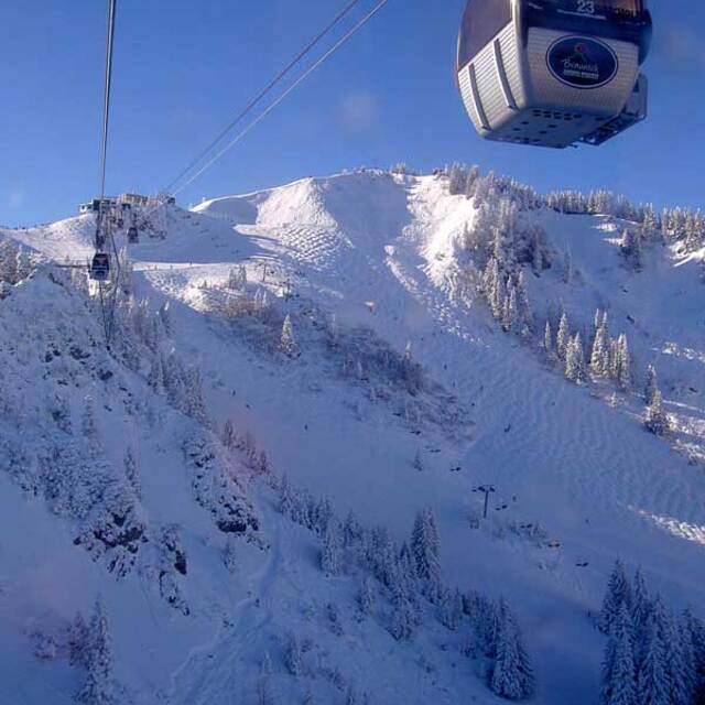
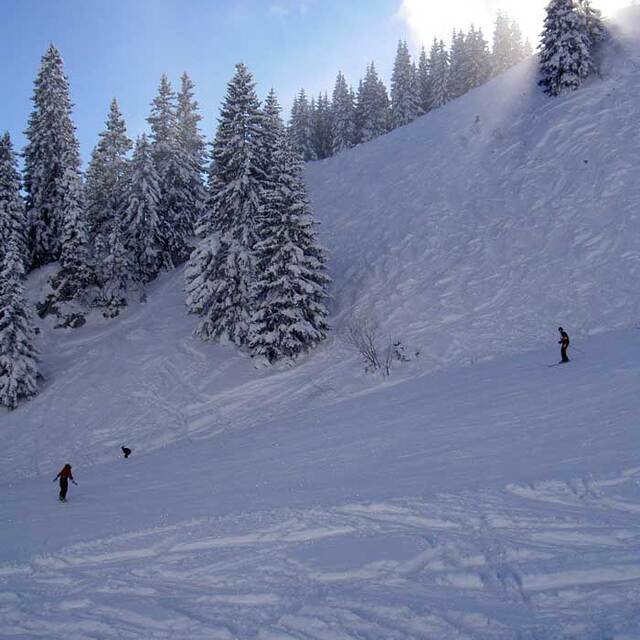
Recensies van bezoekers van Lenggries
Algemeen 4.2 Gebaseerd op 11 Stem(men) en 2 beoordelingen
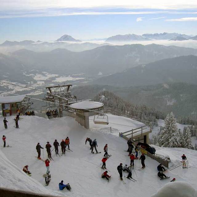
I was a military brat that had the privalidge to grow up and spend 17 years in the Bad Toelz/ Lenggries area. My last 5 years in Germany I lived in Lenggries and can tell you it was an awesome experience. The locals are great and welcoming. I also know many of the bar/restaurant owners personally in town and, more importantly, on the ski slopes. I haven't been to very many resorts/towns in Germany. Austria, Italy or the USA that still have that hometown feeling and are not yet commercialized as if skiing into a McDonalds on the slopes. Lenggries is a very traditional town and yet only 1 hour by train from Munich, which makes it a very popular destination for people in that region. Sure there are larger and more popular resorts to ski in the area, but you can't beat that Bavarian Gemuetlichkeit in Lenggries and the lift ticket prices compared to Garmisch or some of the other larger resorts. I have skied many resorts in southern Europe and am always drawn back to Lenggries every year for that typical Bavarian charm.
Algemeen: 4.2 Gebaseerd op 11 Stem(men) en 2 beoordelingen
Sneeuwzekerheid
3.1
Piste Vercheidenheid
4.1
Off-Piste
3.0
Landschap
5.0
Na het Skiën
3.2
GLENN JENSEN van United States schrijft:
I was a military brat that had the privalidge to grow up and spend 17 years in the Bad Toelz/ Lenggries area. My last 5 years in Germany I lived in Lenggries and can tell you it was an awesome experience. The locals are great and welcoming. I also know many of the bar/restaurant owners personally in town and, more importantly, on the ski slopes. I haven't been to very many resorts/towns in Germany. Austria, Italy or the USA that still have that hometown feeling and are not yet commercialized as if skiing into a McDonalds on the slopes. Lenggries is a very traditional town and yet only 1 hour by train from Munich, which makes it a very popular destination for people in that region. Sure there are larger and more popular resorts to ski in the area, but you can't beat that Bavarian Gemuetlichkeit in Lenggries and the lift ticket prices compared to Garmisch or some of the other larger resorts. I have skied many resorts in southern Europe and am always drawn back to Lenggries every year for that typical Bavarian charm.
Gratis Snow-Forecast.com weer-widget voor op je website
De skiweer-widget voor Lenggries is beschikbaar om gratis op te nemen op externe websites. De widget levert een dagelijkse samenvatting van onze sneeuwverwachtingen voor Lenggries en de huidige weersomstandigheden daar. Ga naar de configuratiepagina en volg de drie eenvoudige stappen om de aangepaste html-code te kopiëren en in uw site te plakken. U kunt de hoogte van de sneeuwvoorspelling kiezen (top, midden van de berg of dalstation) en metrische of imperiale eenheden voor de sneeuwverwachting, aangepast op uw eigen website…. Klik hier om de code te krijgen.


 Nearest