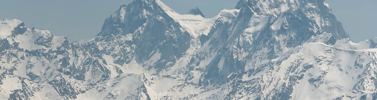


America’s Next Indoor Snow Centre Takes Shape
Construction of a new indoor snow centre for skiers, boarders and tubers appears to be making good progress at Heritage Farm in Wayne County, West Virginia.

Next 3 days weather summary:Nieuwe sneeuw besprenkeling. Bevriezen-ontdooien voorwaarden (max 4°C op woensdagavond, min 0°C op dinsdagavond). Afnemende wind (frisse wind van de W op woensdagavond, Lichte wind van de NW bij vrijdagochtend). | Dagen 4-6 Grainau WeerssamenvattingMatige regen (totaal 16.0mm), zwaarst op zondagochtend. Zeer milde (max 10°C op zaterdagmiddag, min 2°C op zondagavond). Meer wind (kalm op zondagochtend, sterke wind van de WNW bij zondagavond). | ||||||||||||||||
din 21 | woensdag 22 | donderdag 23 | vrijdag 24 | zaterdag 25 | zondag 26 | ||||||||||||
PM | nacht | AM | PM | nacht | AM | PM | nacht | AM | PM | nacht | AM | PM | nacht | AM | PM | nacht | |
sneeuw buien | sneeuw buien | helder | licht bewolkt | licht bewolkt | sneeuw buien | lichte sneeuw | sneeuw buien | helder | helder | licht bewolkt | helder | licht bewolkt | regenbuien | lichte regen | lichte regen | gem. regen | |
km/h | |||||||||||||||||
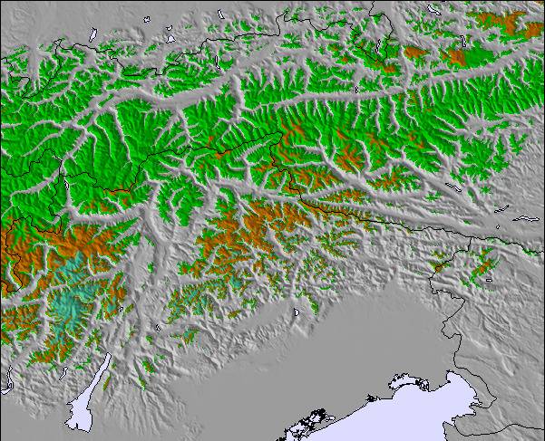
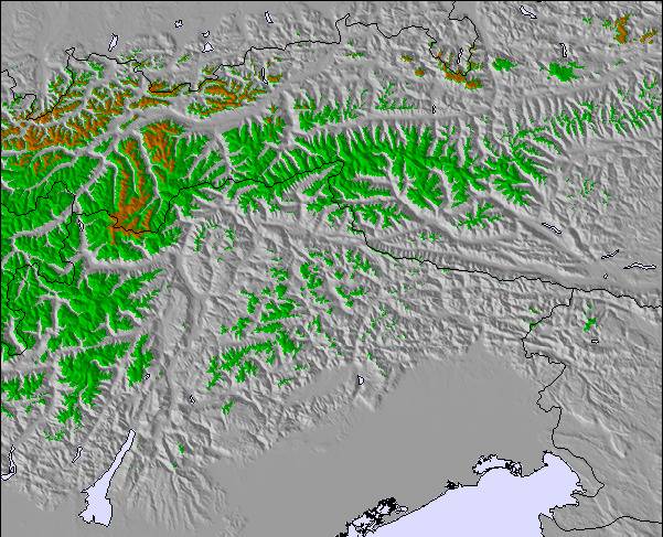
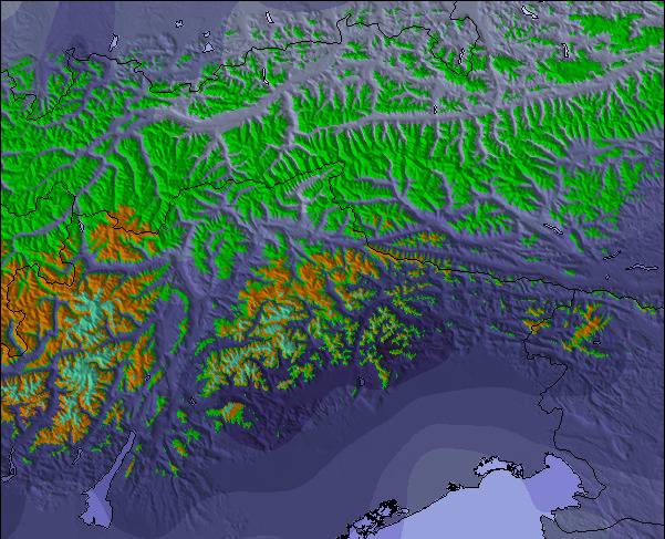
Sneeuw kaart |  |  |  |  |  |  | |||||||||||
— | — | — | — | — | — | 1 | 1 | — | — | — | — | — | — | — | — | — | |
mm | — | — | — | — | — | — | — | — | — | — | — | — | — | 2 | 3 | 3 | 6 |
max °C | 2 | 1 | 2 | 3 | 4 | 0 | 1 | 1 | 4 | 6 | 7 | 8 | 10 | 10 | 4 | 3 | 3 |
min °C | 2 | 0 | 1 | 2 | 1 | 0 | 1 | 0 | 2 | 4 | 6 | 6 | 9 | 6 | 3 | 3 | 2 |
chill °C | -2 | -5 | -4 | -1 | -6 | -7 | -5 | -6 | -2 | 2 | 2 | 1 | 7 | 5 | -1 | -2 | -4 |
Vocht. % | 86 | 88 | 27 | 74 | 80 | 88 | 86 | 78 | 14 | 31 | 22 | 30 | 46 | 70 | 96 | 95 | 94 |
Vriespunt Niveau m | 3100 | 2800 | 3150 | 3150 | 3100 | 2900 | 3000 | 2850 | 3450 | 3750 | 3950 | 4000 | 4200 | 3900 | 3300 | 3300 | 3200 |
— | — | 5:39 | — | — | 5:41 | — | — | 5:43 | — | — | 5:43 | — | — | 5:45 | — | — | |
— | 9:04 | — | — | 9:02 | — | — | 9:01 | — | — | 9:00 | — | — | 8:59 | — | — | 8:58 | |
Word pro en carve uit:
Lawine-informatie: European Avalanche Warning Services (EAWS)
Laatste sneeuwrapporten in de buurt van Grainau:
| Sneeuwdiepte op de top: | — |
|---|---|
| Sneeuwdiepte beneden: | — |
| Diepte verse sneeuw: | — |
| Laatste sneeuwval: | 10 Jun 2026 |
0.0 | Bluebird-poederdagen Verse sneeuw, meestal zonnig, lichte wind. |
|---|---|
0.3 | Poederdagen Verse sneeuw, vrij zonnig, wat wind. |
0.0 | Bluebird-dagen Gemiddelde sneeuw, meestal zonnig, lichte wind. |
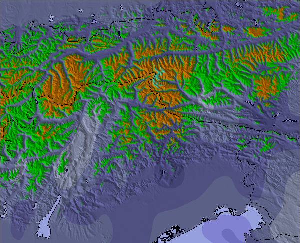
De bovenstaande tabel toont de weersverwachting voor Grainau op een specifieke hoogte van 2831 m. Onze uiterst precieze weermodellen berekenen sneeuwverwachtingen voor de top, midden en dalstations van Grainau. Voor weersverwachtingen op andere hoogtes, gebruik de tabbladen boven de tabel. Voor meer weer overzicht, zie de weerkaart van Germany.
Klik hier voor meer informatie over sneeuwhoogten en hoe we onze temperaturen berekenen.
I have been to Grainau every year for the last 6 years and the prices never change. There's never a price rise. We pay around 70 euros a night for 4 people and if you try and find a cheaper room so close to a major ski area you're going to have a problem. Grainau is a small sleepy village 5 mins up the road from Garmisch and it's only a train ride away from the Zugspitze, the highest mountain in Germany. The skiing up there is amazing with crisp snow and the feeling of a true French Alpine resort. But you better get used to T-bars as that's pretty much all there is up there. The classic area is much more German with tree lined slopes, loud Euro pop coming out of Garmisher Hause and the millions spent on the lifts cable cars and snow makeing has made it all the better. Access to Grainau is suprisingly easy with Munich being only an hour drive and with it being right on the edge of the Alps there aren't any mountain passes to deal with.
frazer attrill van United Kingdom schrijft:
I have been to Grainau every year for the last 6 years and the prices never change. There's never a price rise. We pay around 70 euros a night for 4 people and if you try and find a cheaper room so close to a major ski area you're going to have a problem. Grainau is a small sleepy village 5 mins up the road from Garmisch and it's only a train ride away from the Zugspitze, the highest mountain in Germany. The skiing up there is amazing with crisp snow and the feeling of a true French Alpine resort. But you better get used to T-bars as that's pretty much all there is up there. The classic area is much more German with tree lined slopes, loud Euro pop coming out of Garmisher Hause and the millions spent on the lifts cable cars and snow makeing has made it all the better. Access to Grainau is suprisingly easy with Munich being only an hour drive and with it being right on the edge of the Alps there aren't any mountain passes to deal with.

 Nearest